Stakeholders Oppose Draft Assessment for Comanche National Grasslands
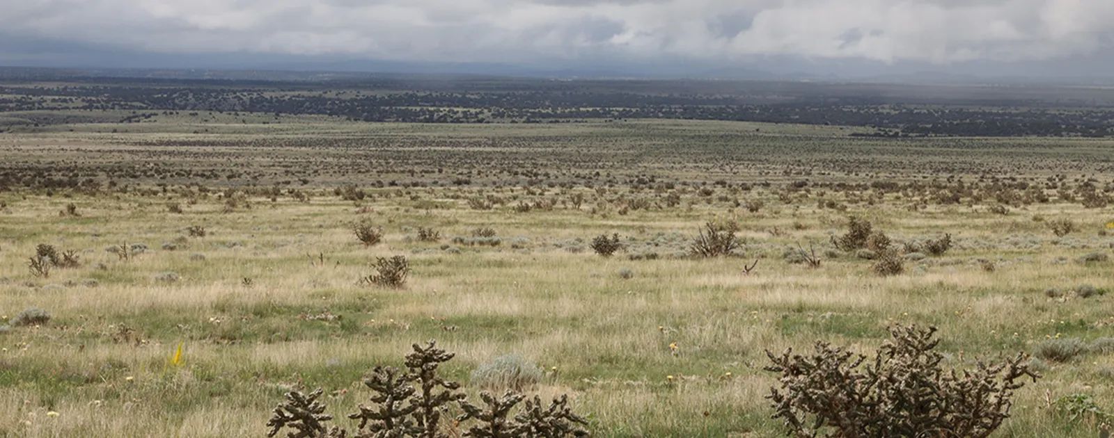
WASHINGTON, D.C., October 3, 2025 – Stakeholders within the Cimarron and Comanche National Grasslands Timpas Unit in Baca, Las Animas, and Otero counties in southeastern Colorado and Morton and Stevens counties in Kansas are fighting the U.S. Forest Service and the recently released draft assessment. The 1,500-page document was posted for comment on the National Register with about 30 days for comments. Stakeholders are concerned that the USFS is attempting to end grazing on the land and failed to use the best available scientific information to inform the draft.
According to a presentation by Beth Davis, USFS land management planner, the pre-assessment occurred from October 2023 to October 2024, assessment period from November 2024 to September 2025, plan development from October 2025 to August 2026 with Draft Plan review from October 2025 to August 2026 and Final Plan from March 2026 to August 2026 with the objection phase and final decision from August 2026 to November 2026.
Currently, the plan is in the assessment phase during which the USFS determines existing ecological, social and economic trends; a baseline for necessary plan changes; and other concurrent planning processes occur including the species of conservation concern, the wilderness recommendation process, and the Wild and Scenic Rivers eligibility process.
At a Sept. 24 Zoom meeting that included USFS staff and members of the Timpas Grazing Association, retired Otero County Commissioner Kevin Karney explained the long history of private property battles in the area. The region's agriculture families, he said, have long fought buy- and dry-type water deals with metro Colorado cities, and faced the federal government and Department of Defense during the Pinon Canyon Expansion. The expansion of the Pinon Canyon Maneuver Site, the largest condemnation in U.S. history at 238,000 acres. In 2003, the Army sought to acquire an additional 6.9 million acres of privately owned land and the Comanche National Grasslands for large-scale military training operations. Ranching groups, local citizens, and private property groups opposed the expansion and the Army scaled back their efforts to include only 418,000 acres only purchased from willing sellers. The expansion plans were ultimately cancelled in 2013.
Karney cited ongoing struggles between the county and the USFS and the lack of emergency services within the Comanche National Grasslands.
"A lot of it isn't in a rural fire district and trying to get mutual aid and working with the rural fire districts and Forest Service to have some equipment and manpower here to do initial attack and not be dependent upon the rural fire departments to do initial attack," he said.
There are also restrictions on fire departments entering federally owned property and other obstacles to maintaining fire coverage. There is not, he said, law enforcement on the grasslands, the potential for additional multiple uses on the land will be complicated by a lack of services and a lack of resources to provide emergency services.
Karney said the USFS staff indicated at a meeting with the TGA that the USFS lacks the budget to send staff involved in the draft assessment to southeastern Colorado to the Comanche National Grasslands, which raises concerns about the financial resources to differently manage the lands.
LEININGER RANCH
Korry Lewis Eathorne represents the Leininger Ranch owned by Dr. Zane and Barb Leininger, who are allotment holders and permittees within the Timpas Unit of the Comanche National Grasslands. Lewis Eathorne submitted comments on behalf of the ranch and stated the concern that the draft assessment is not properly focused on maintaining livestock grazing within the CNG. The ranch also vehemently opposes any national designations including National Wilderness Preservation System and National Wild and Scenic Rivers System.
National Grasslands, Lewis Eathorne said, are by statute to promote development of grassland agriculture unless otherwise designated by Congress. The lack of acknowledgement in the draft assessment of the ranchers' efforts and improvements over decades to properly manage the land and resources within the CNG could, she said, prove detrimental to the ranchers' livelihoods. Additionally, the draft assessment notes the alleged benefits of prairie dogs to the ecosystem but fails to mention their negative effect on livestock grazing.
The comments also point out the CNG's unsuitability for black-footed ferret reintroduction and plans for inclusion of the land in the National Wilderness Preservation System and which rivers may be eligible or suitable for inclusion in the National Wild and Scenic Rivers System as required by the Planning Rule.
Lewis Eathorne said this is another deviation from the original purpose for the Comanche National Grassland, and "these two national (or global) initiatives are designed to remove all livestock grazing from the land, among other harmful goals."
TIMPAS GRAZING ASSOCIATION
Andee Leininger, owner of SECO Ranch Planning and a professional in range management as certified through the Society for Range Management, was contracted by the Timpas Grazing District to submit comments to USFS on their behalf. From a range management perspective, she detailed concerns about the lack of accuracy and objectivity of the scientific data and standards included in the draft assessment.
Among the concerns documented in the comments submitted by TGA is the failure of the USFS to contact landowners and permittees within the Timpas Unit for input "regarding current ecological conditions, grazing management or vegetation management on those private acres. That information could be used to help determine how much ecosystem fragmentation actually exists due to land ownership on the larger landscape, and if any large-scale action would actually need to take place to maintain current ecosystems and biodiversity."
Leininger said she signed up for email notifications for meetings related to the process. She received one email a few hours after a webinar had taken place, called USFS, and was told the email notification system hadn't been functioning correctly and the people on the notification list had missed three webinars that were not rescheduled to allow participation. One webinar was added eventually at the request of stakeholders, and the comment period was extended by 14 days.
TGA also expressed concern about the sources used to establish species present, species of conservation concern, and the threats to the species of conservation concern.
Leininger worked as an intern for Natural Resources Conservation Service in 2012 and helped collect data for ecological site descriptions during the time when NRCS, the Bureau of Land Management and the USFS were making a concerted effort to cooperate on rangelands with NRCS serving as the technical arm of the three to collect data in the field. From those efforts, the three agencies published the Interagency Ecological Site Handbook for Rangelands in January 2013. As she was reviewing the draft assessment, she said she noted the lack of ecological site descriptions as there are no references to the handbook anywhere in the draft assessment and fewer than 10 references to ecological site descriptions.
"The (ecological site descriptions) aren't quoted very often in this document and some of these dominant plant species tables they have for shortgrass prairie and canyonlands are referencing some workshop held in Washington D.C., last year," Leininger said.
There was a directive from early 2010s that guided USFS and NRCS to work together to gather and compile data that would then be used to inform management decisions. She said it begs the question why USFS would choose a workshop on the East Coast when the NRCS data gathered by professionals on the lands in question would be preferential. She found it concerning enough that she voiced the concern to USFS staff during a webinar. It was then that staff admitted, after repeated requests, identified a third party in Texas contracted to author the draft assessment.
HABITAT THREATS?
The appendixes are primarily listing species of conservation concern and Leininger said as she reviewed that list, livestock grazing, farming and ranching, were repeatedly listed as threats to the habitat.
"Some of those species were milkweeds, which are toxic to livestock," she said. "How can livestock threaten a plant they can't even eat without becoming sick? It's full of things that just don't make sense."
She continued reading and reviewed a document online in the plan revision library outlining the regional forester's process for identifying species of conservation concern.
"It said the plant must be native, known to occur in the plan area, and it must meet all four indicators of concern," she said. "To define 'known to occur in the plan area,' it says the species must be established or becoming established during the time of plan development. There's half their list gone already — some of the last known dates they have for things known to occur in the plan area are in the 1970s or 1990s or early 2000s which is not the time of plan development."
The information, including the number of times the species occurs in the plan area comes either from the Colorado Natural Heritage Program or an auto-generated source. According to TGA's comments, there is no statement in the Draft Assessment that shows an attempt to validate the information found on these different website sources with in-person, boots-on-the-ground plant and animal inventories. In fact, the iDigBio (Integrated Digitized Biocollections) website states "Although iDigBio is a repository for recordsets of primary biodiversity data of vouchered natural history collections, it is not a data repository as defined by most journals.
Accepting individual researcher datasets, even those consisting of vouchered, natural history specimen digitized data and media, currently falls outside of the Scope of iDigBio. A data repository in its broadest sense is a destination for data storage. There are many online data repositories, and several organizations, such as re3data.org (Registry of Research Data Repositories) and biosharing.org Information Resources provide curated listings of data repositories." In other words, this website makes no attempt to screen data or articles for accuracy or attempt to determine if articles have been peer-reviewed. This one source is cited within the Draft Assessment text as "(Van Scoyoc 2024)" and is quoted no less than 550 times.
One of the concerns of the TGA is the perception that the plan assessment is laying the groundwork to end livestock grazing. According to their submitted comments, TGA appreciates the draft assessment recognizes the economic importance of grazing to local economies and the importance of adaptive grazing management in the mitigation of wind erosion, it's concerning that grazing is listed as a specific threat to the habitat of many species of concern.
Further, the draft assessment states, "The expansion of agriculture and urbanization across the Great Plains and the areas surrounding and within the Cimarron and Comanche National Grasslands area have resulted in pollution, hydrologic disturbance and physical modification of streams. The Cimarron and Comanche National Grasslands riparian areas and non-playas wetlands are affected by upstream and upslope activities that occur on and off National Forest System lands due to mixed ownership within the project boundary."
Urbanization, or the formation of cities, has not occurred in the plan area. The town of Timpas is unincorporated with fewer than 10 houses, and the U.S. Post Office ceased operation in 1970. The other towns within the area, Benton, Ayer, Bloom and Iron Springs, are all uninhabited and have been for decades. If there is urbanization in either the Carrizo Unit of the Comanche NG or the Cimarron NG, the draft assessment should state where that occurred and the USFS definition of urbanization.
Agriculture is also not defined, though TGA said any reference to farming is incorrect, as grazing is the only agriculture use on USFS lands within the Timpas Unit. Additionally, the draft assessment claims the main stem of the Purgatoire River "is impaired for Water Supply due to high concentrations of arsenic and manganese. Both of these contaminants are naturally occurring but have concentrations that exceed the acceptable limits for water supply use (EPA 2025e)." The next bullet point states "Timpas Creek (Main Stem): This creek is impaired for Aquatic Life Warm Water – Class 1 and Water Supply due to iron, selenium, and arsenic contamination. The presence of these contaminants has led to degradation of both aquatic life and water supply (EPA 2025e)."
The draft assessment states the body of water is impaired due to naturally occurring elements and according to TGA, should not contain a conflicting statement blaming urbanization and agriculture for stream pollution. Further, the air quality section of the draft assessment was compiled through page 160)." The EMDS model itself, according to the USDA-USFS Pacific Northwest Research Station website, uses "…the latest technology from geographic information systems (GIS), including ArcGIS Pro and QGIS, as well as logic-based reasoning and a variety of decision modeling technologies. (USFS PNRS)" No in-person terrestrial assessments were completed in the plan area and the ratings were assigned without in-person observations.
Source: Rachel Gabel, The Fence Post Magazine and Western Ag Network


